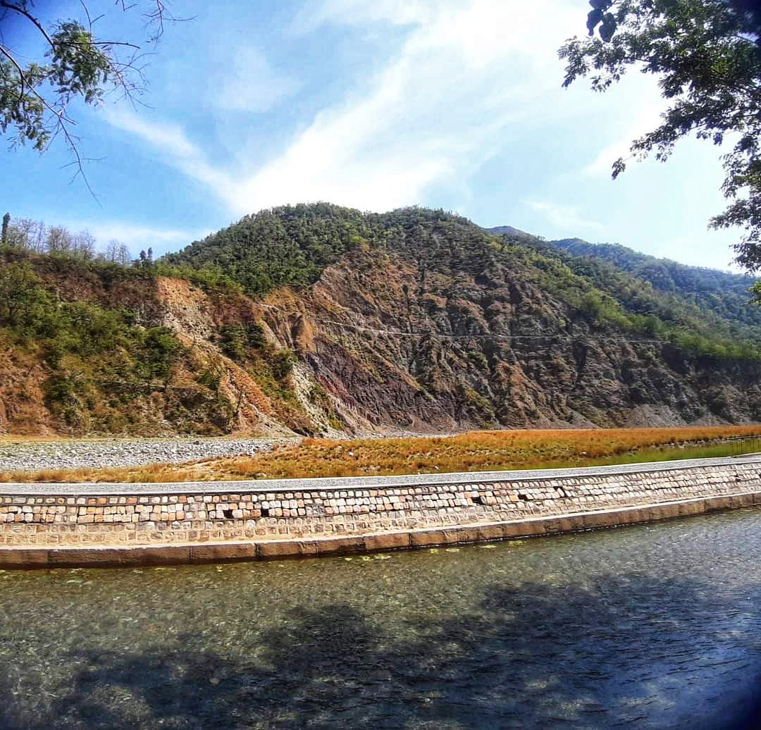
It’s the month of June and summer vacations have just begun. The monsoon season is about to begin and very soon the rivers and canals in Uttarakhand will be overflowing, so we planned for a short offbeat road trip towards the outskirts of Dehradun near a place called Katapatthar. It took us around two and half hours to reach the destination from Landour, Mussoorie. Katapatthar is roughly around 75 km from Landour. The scenic landscape is situated around the outskirts of Dehradun city alongside river Yamuna. One can see the beautiful Jaunsar Bawar range across the river bank. Katapatthar has historical linkage to the periods of Mahabharata and the ancient Ashoka Empire. The lush green paddy fields, agricultural lands and village life pacify restless eyes after a long drive. The remarkable architectural designs and engineering of the water canals created during imperial times are still functioning well and support irrigation facilities to the nearby fields. According to the Uttarakhand Irrigation Department, in the year, 1840-41, Captain Cautley prepared a project for irrigating the extreme western portion of the Dun by means of a canal fed from the river Yamuna. The construction of the work was warmly recommended by the Civil authorities as the only means of developing a thinly populated but rich tract of country in which there was then no water available, not only for irrigation, but even for drinking and domestic purposes, beyond that supplied by a single well in the village of Pirthipur, but the project met with some opposition from the Canal Department, on the grounds that the diversion of a volume of about 80 cusec from the river would cause a serious diminution in the supply available for the Eastern and Western Yamuna Canals. The project remained in abeyance for some 8 or 10 years, after which the construction of the work was taken up, and the canal was opened in May 1854. As soon as we entered the Katapatthar village we were welcomed by the dense Mango and litchi orchards. The clear waters gurgling through the channels create a mindful soothing ambience. After many long days I was walking under the shade of the orchards. I was astonished that the Mango trees had no mangoes although it is the mango season in the country, which I later found out that they were already harvested as the bats create menace partying on the mangoes. The local people told me that the bats already feasted on the litchi now mango is their new delight. I found the bats resting on the tall Eucalyptus trees before entering Katapatthar village. The villagers were very generous and they gifted me with delicious Langra mango. Although Alfonso mango is one of the most priced varieties of mango worldwide, I have a close affinity with the Langra mangoes. We paced forward and I found that the locality is also home to numerous other plant species with intermittent Dalbergia sissoo, mulberry and Ringal bamboo species, Murraya koenigii and Ficus sp. Came across this beautiful fern Northern maidenhair (Adiantum pedatum). Also came across this thorny bush, Carrisa opaca also known as Karondi. Carissa opaca has ethnomedicinal properties (Apocynaceae), which is traditionally used for a number of purposes, including jaundice, hepatitis, rheumatism and asthma. The trail towards the canal had slight gradient and gentle slopes also somewhere muddy. As the trail comes to the end, one can see the picturesque view of the panorama of the beautiful river bed flowing alongside the canal overlooking the majestic Jaunsar mountain ranges. The clear river Yamuna flowing through the boulders and cobbles is still in the youth stage in this geographical terrain. We too couldn’t resist the clear water flowing and got our feet in the soothing water. On my way back I came across these old canal switches which were used to control the inflow of water flowing into the landmass, now in ruins. There was also this old water wheel on the canal. After some time relaxing in the water, I heard the sirens blow. The guards said that they will be opening the channels and the water levels will rise. So it was also time for us to return home. Somewhere, I was happy that the site was not yet commercialised for tourists, otherwise the place would have lost its essence, although litter was also eminent alongside the trail and riverbank. It was overall a lovely experience for me and my family. I humbly request all tourists and travellers to travel responsibly and protect and conserve the serenity of the tourist sites. Thank you Like, share and follow. ? https://youtu.be/nB8ZXgwaYfo https://www.facebook.com/Dr.ChandrimaDebi/ https://www.instagram.com/debichandrima/ https://www.sumanmitra.com/ ©All images and content are subjected to copyright © 2022 chandrimadebi https://chandrimadebi.com
Citylight limit line: Mussoorie – Dehradun
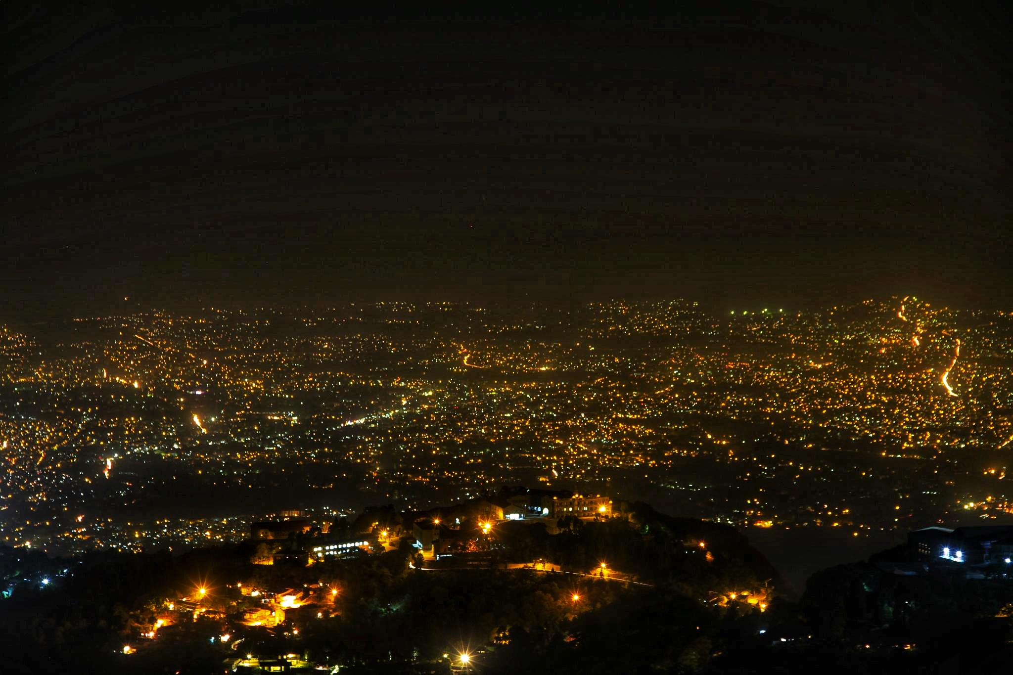
The citylight limit line is the highest limit perpetual of light covering the cities during evening time. It can be observed from an elevation of about 1500msl. Ideal locations to observe the citylight limit are TV towers, hilltops, Hawaghar and skyscrapers. It is an irregular line which divides the urban areas from the forests, rural areas, degraded land, agricultural fields i.e. areas with less human interference. The citylight limit of elevated landmass can also be observed from the plains. It can be best observed during clear weather during evening time when the sun is set. The citylight limit line of Mussoorie as viewed from Dehradun looks as if the Queen of the hills is wearing a shimmering diamond necklace for the evening. The citylight limit line can also be a parameter to know the rate of urbanization of cities. The city’s light intensity is high around the heart or core of the city and slowly wanes away towards its boundary. The lights give a shimmering effect due to the interference of the light waves, diffraction, reflection and refraction. Based on the extent of city area, rate of urbanization, human settlements, road traffic, land boundary and availability of electricity supply during evening time, the citylight limit line forms different patterns and shape.The citylight limit line forms irregular line which are mainly Straight, Curved, Dotted, Dashed, Contour, Zig Zag, Implied, Curvilinear line. It is difficult to make out the entire citylight limit line from one particular aspect of elevation. However, there are following patterns which are mainly Polygonal, Clustered, Compact, Semi-compact, Dispersed, Radial and many more. With changes in globalisation and urbanization the citylight limit line can also shift and change shapes and patterns. High levels of air pollution, smoke or fog can affect the visibility of the citylight limit line. In Mussoorie, the citylight limit line of Dehradun is best visible from the Mussoorie Dehradun highway, Mall road, Barlowganj and Jhadipani areas. The shimmering bright lights capture artistic imaginations and draw tourists to witness the sunset and the mesmerizing city lights. Thank you Like, share and follow. ? https://youtu.be/wwT_61luGIk https://www.facebook.com/Dr.ChandrimaDebi/ https://www.instagram.com/debichandrima/ https://www.sumanmitra.com/ ©All images and content are subjected to copyright © 2022–2023 https://chandrimadebi.com


